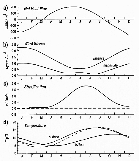
Figure 6. a) Annual cycle of net surface heat flux in the Georges Bank
region; b) annual cycle of the magnitude and variance of the wind stress in the Georges
Bank region; c) annual cycle of density differences between surface and bottom at the
well-mixed site (dashed line) and the stratified site (solid line) on the southern
flank of Georges Bank indicated in Figure 5; d) annual cycle of water column temperature
at the mixed site (dashed line) and the surface and bottom temperature at the stratified
site (solid lines).