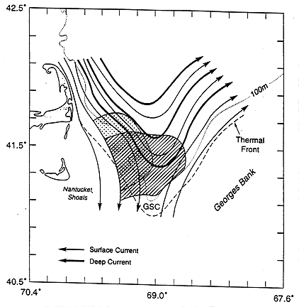
Figure 2. Conceptual schematic of upper and lower layer
circulation in the northern GSC during late spring. Solid lines are
near surface currents, heavy solid lines are deep currents associated
with Maine Intermediate Water (MIW), and dashed lines are the locations
of the tidal mixing thermal fronts. Shaded areas with dots and lines
are the convergence zones for April 1988 and June 1989 surveys,
respectively. (C. Chen, R. C. Beardsley and R. Limeburner, "Variability
of water properties and currents in late spring in the northern Great
South Channel", Cont. Shelf Res., submitted).